
TacticalCenter
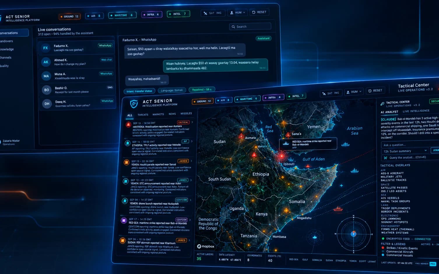
Real-time telemetry tracking for military assets, flight paths, maritime vectors, and weather intelligence.
- Real-Time Latency
- Sub-second geospatial flight and vessel telemetry.
- Multi-Domain GIS
- Unified tracking for aviation, naval, and ground assets
- Automated Security
- Instant OSINT threat alerts and border event parsing.
The problem
Fragmented data feeds and high latency hinder real-time situational awareness during critical geopolitical events.
The outcome
A low-latency dashboard delivering unified tracking, live telemetry, and automated threat alerts for defence teams.
What it does
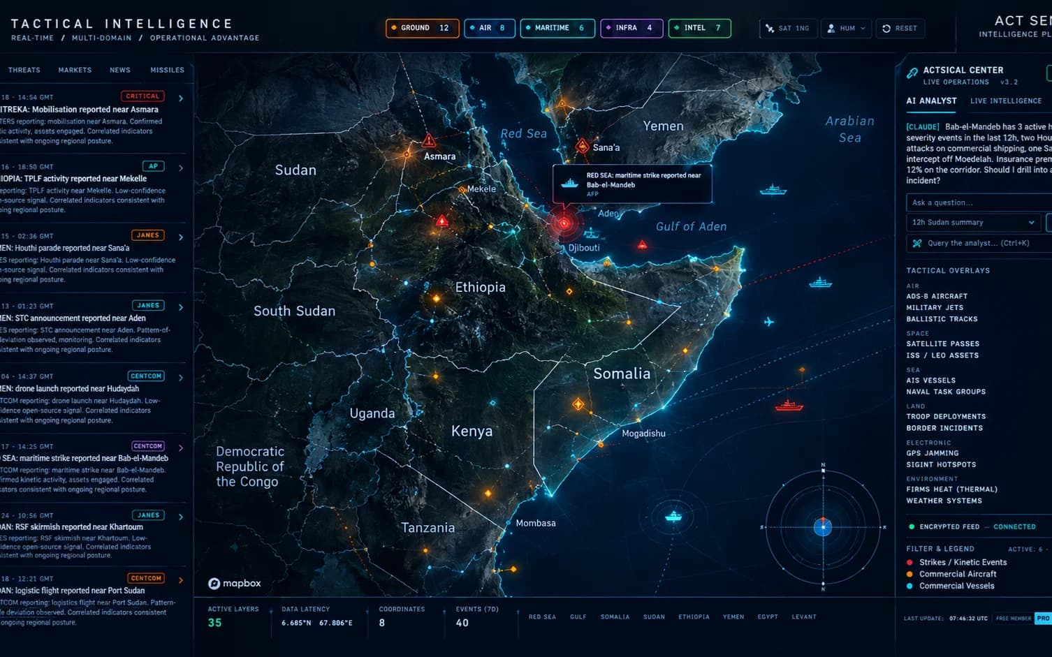
Advanced GIS Radar Engine
High-performance 2D/3D vector and satellite mapping powered by Mapbox GL JS.
Multi-Domain Telemetry
Live tracking for commercial aviation, military assets, naval vessels, and ground units.
Dynamic Meteorological Overlays
Real-time weather satellite layers, surface temperatures, and atmospheric intelligence.
Automated Threat & Event Parsing
Continuous OSINT ingestion provides instant alerts on border developments and crisis zones.
Encrypted Command Portal
Secure role-based access control and isolated data streams for high-security operations.
Custom Alert Engine
Set custom spatial boundaries and receive instant alerts on boundary breaches.
How it works
Data Ingestion
Continuous automated polling fetches high-frequency telemetry from global OSINT APIs and satellite streams via Supabase Edge Functions.
Spatial Normalization
The engine standardises geographic coordinates, flight vectors, and naval telemetry onto high-speed map layers.
Real-Time Visualization & Alerts
Operators monitor live tactical feeds, filter intelligence streams, and evaluate regional threat vectors instantly.
Product tour
Where it's used
Case studies built on the same capabilities.

Integrations
- OpenSky Network API
- Mapbox GL JS
- AIS Maritime Tracki
- NOAA/MODIS Satelite
Security and data
Security Point 1
End-to-End Encryption (E2EE) enforced across all live telemetry streams and operational databases.
Security Point 2
Role-Based Access Control (RBAC) coupled with multi-factor authentication (MFA) for all operators.
Plans
Pricing depends on volume and how it's deployed. Tell us what you need and we'll send a proposal.
Starter Tier
Basic flight tracking and public OSINT intelligence feeds.
- Global Flight Tracking
- Standard Map Layers
- Community Support
Pro Plan
Advanced multi-domain telemetry, maritime tracking, and weather feeds.
- Flight & Maritime Tracking
- Weather Satellite Overlays
- Automated OSINT Ticker
- Priority Support
Enterprise Tier
Mission-critical OSINT command center with custom API integrations & E2EE.
- Everything in Professional
- Custom API / Sensor Feeds
- Dedicated VPC & Support
- Advanced Threat Alerts
Questions
Can Tactical Center ingest proprietary or custom API feeds?
Yes, the platform features a flexible webhook and API ingestion engine designed to integrate custom sensors, radar data, or private intelligence streams.
What is the data latency for live tracking feeds?
Telemetry data is processed and rendered with sub-second latency using high-frequency Edge Functions and optimized WebSocket/polling pipelines.
How secure is the operational and telemetry data?
Data is protected via End-to-End Encryption (E2EE) and strict Role-Based Access Control (RBAC).
Does the platform support offline or air-gapped deployments?
Yes, enterprise clients can request secure private cloud or air-gapped server configurations.
How are weather and satellite layers synchronized?
Live meteorological and satellite feeds are updated automatically via NOAA and MODIS APIs.
What kind of technical support is provided for operators?
We provide comprehensive documentation, API integration guides, and dedicated onboarding sessions.
Have a system to build or fix? Tell us about it.
Send a short brief or book a call. We'll reply by email with next steps.